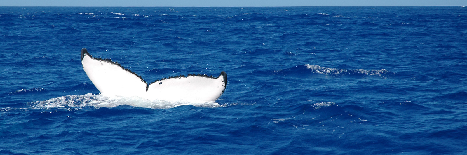
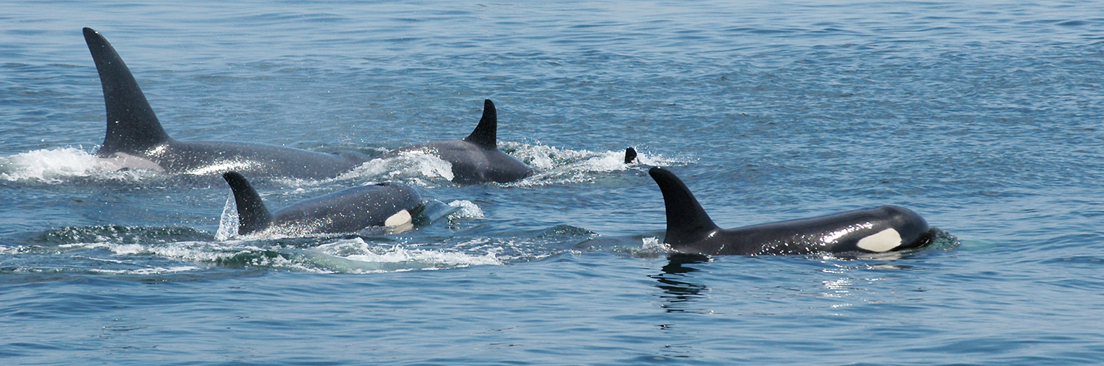
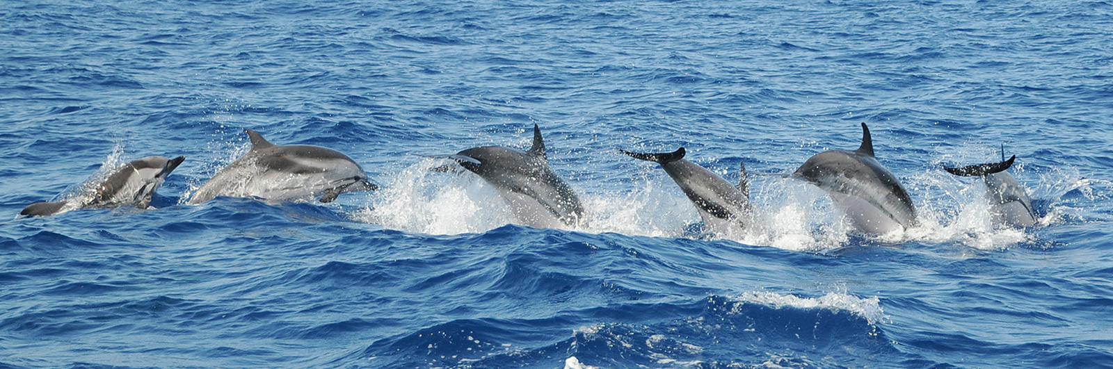

Introduction to PADOC
PADOC stands for Plateforme d’Acquisition de Données d’Observations Cétologiques (that’s for French people). Données is for data, you can easily translate the rest!
It is a powerful tool designed to allow detailed ethological monitoring of wild cetaceans. Useful for naturalists and professionnals, it is particularly fruitful when studying human-induced disturbance affecting wild cetaceans.
PADOC is an Android application. While at sea studying cetacean behavior, it allows to record different data types such as group structure, cetacean movements and positions (speed, course), and surface events (jumps, blows, social behavior, etc.). Time and position are automatically recorded with any entered data, and a CSV file is generated so that the data can be easily processed later.
Between two sightings, an On-effort Survey mode working as a logbook enables you to record positions, environmental datas and other interesting notes even if no cetaceans were encountered during your transect.
PADOC is offered by Groupe de Recherche sur les Cétacés (« GREC »), but GREC never has any access to the data produced or logged by PADOC’s users.
PADOC was publicly released in 2018, and is now available for free on Play Store.

System requirements
PADOC runs on virtually any decent Android device (tablet or smartphone ; in practice we generally use a tablet, that provides a more comfortable display).
PADOC is designed to work without any phone network or mobile data access.
Minimum requirements:
- Screen size: 4.7 inches
- Android version: Jelly Bean (Version 4.1.1, API 16)
Recommended requirements:
- Screen size: 8 inches
- GPS
- Compass
Instructions for use
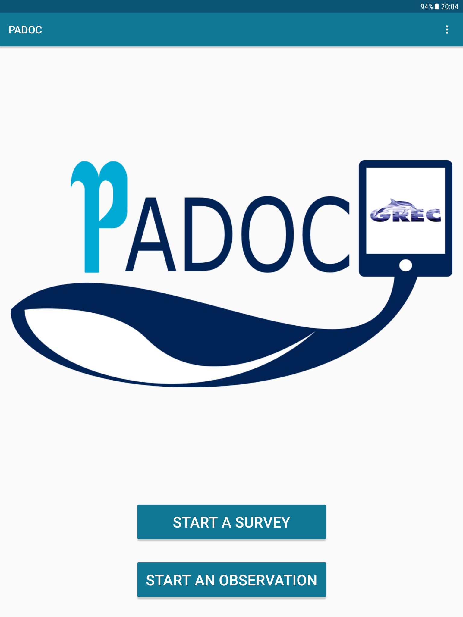
Launch the app by tapping the PADOC icon:
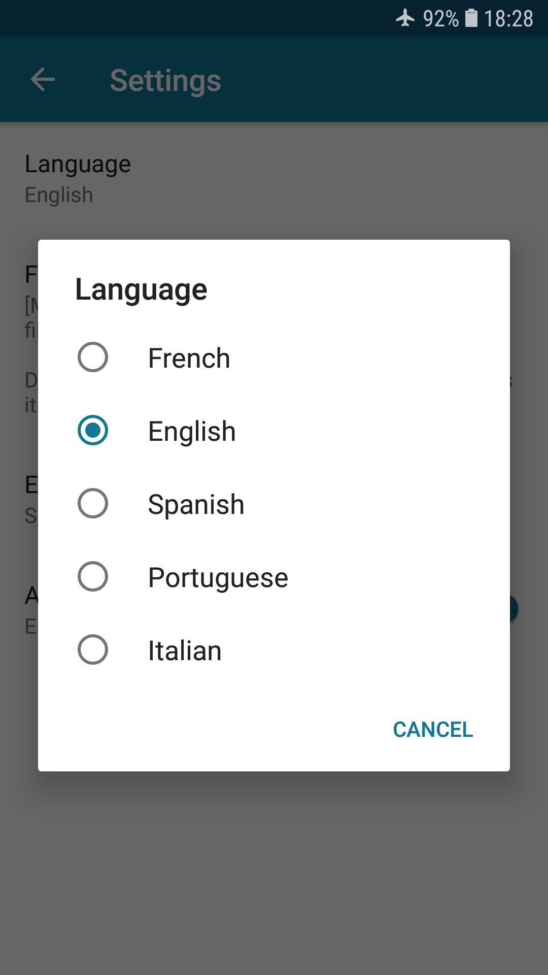
From the home screen, you can tap on the three dots in the top-right corner of the screen to access the options and settings.
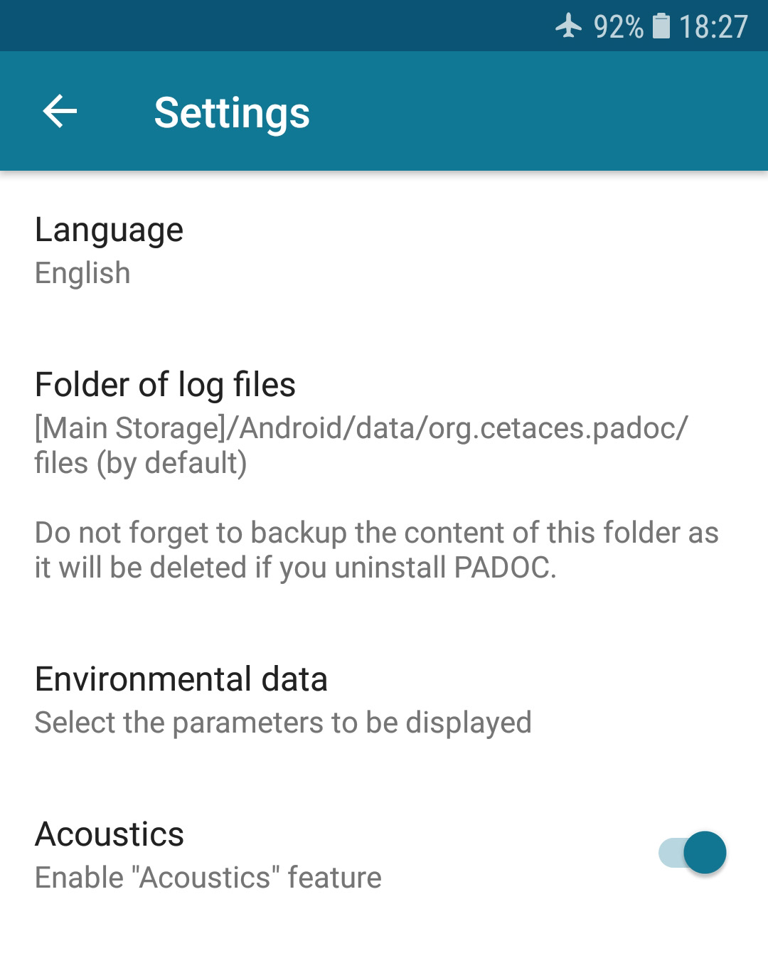
From there you can now:
- change the language of the application (five languages currently available)
- customize the files location on your device (Android v7.0+)
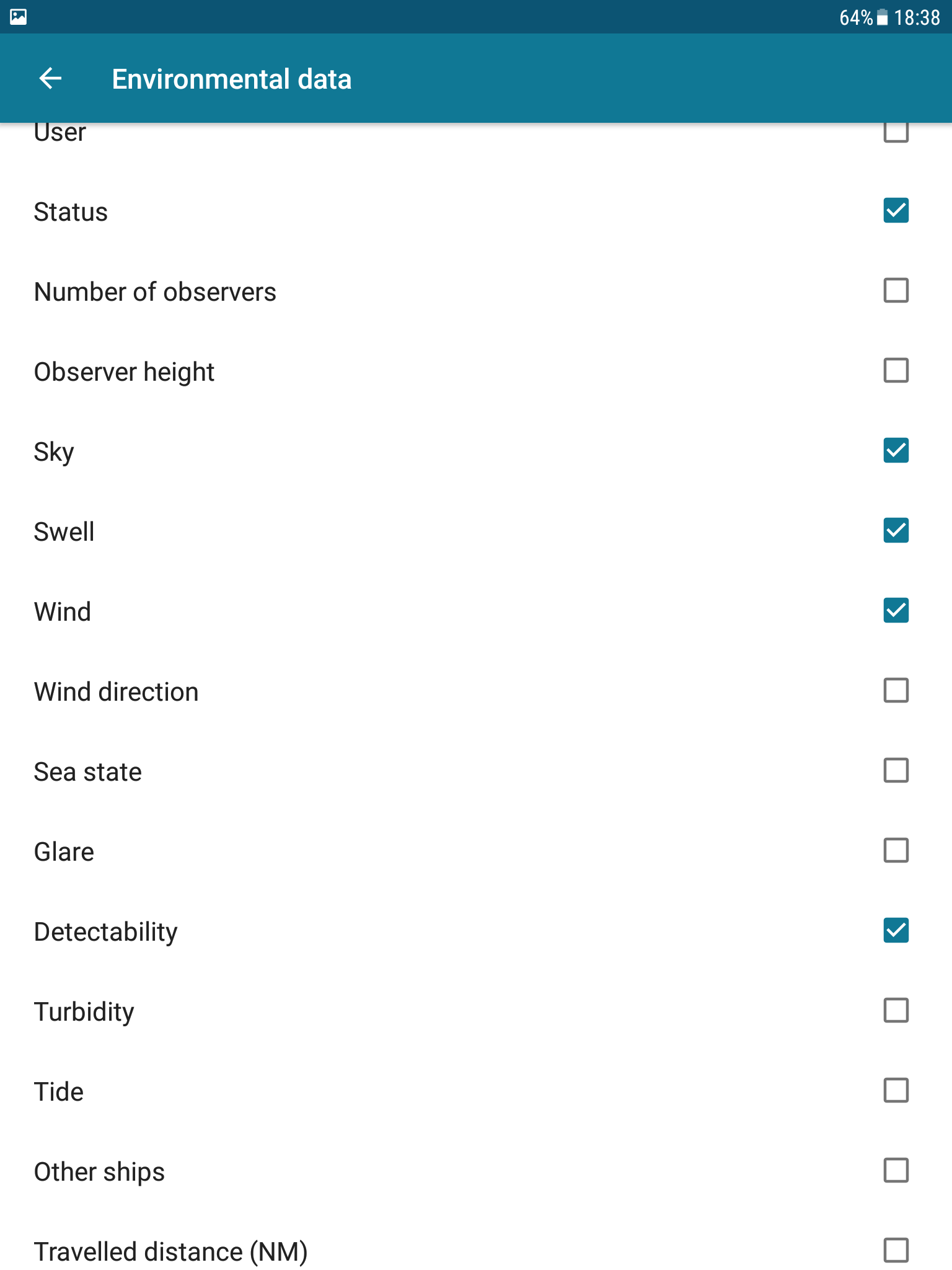
- select the environmental parameters that you want to use in Survey mode
- enable the option for acoustic data entry in Survey mode
- find your previous files
- check the version
Back to the Home screen, you can now start a survey or a behavioural observation (don’t forget to turn the GPS on).
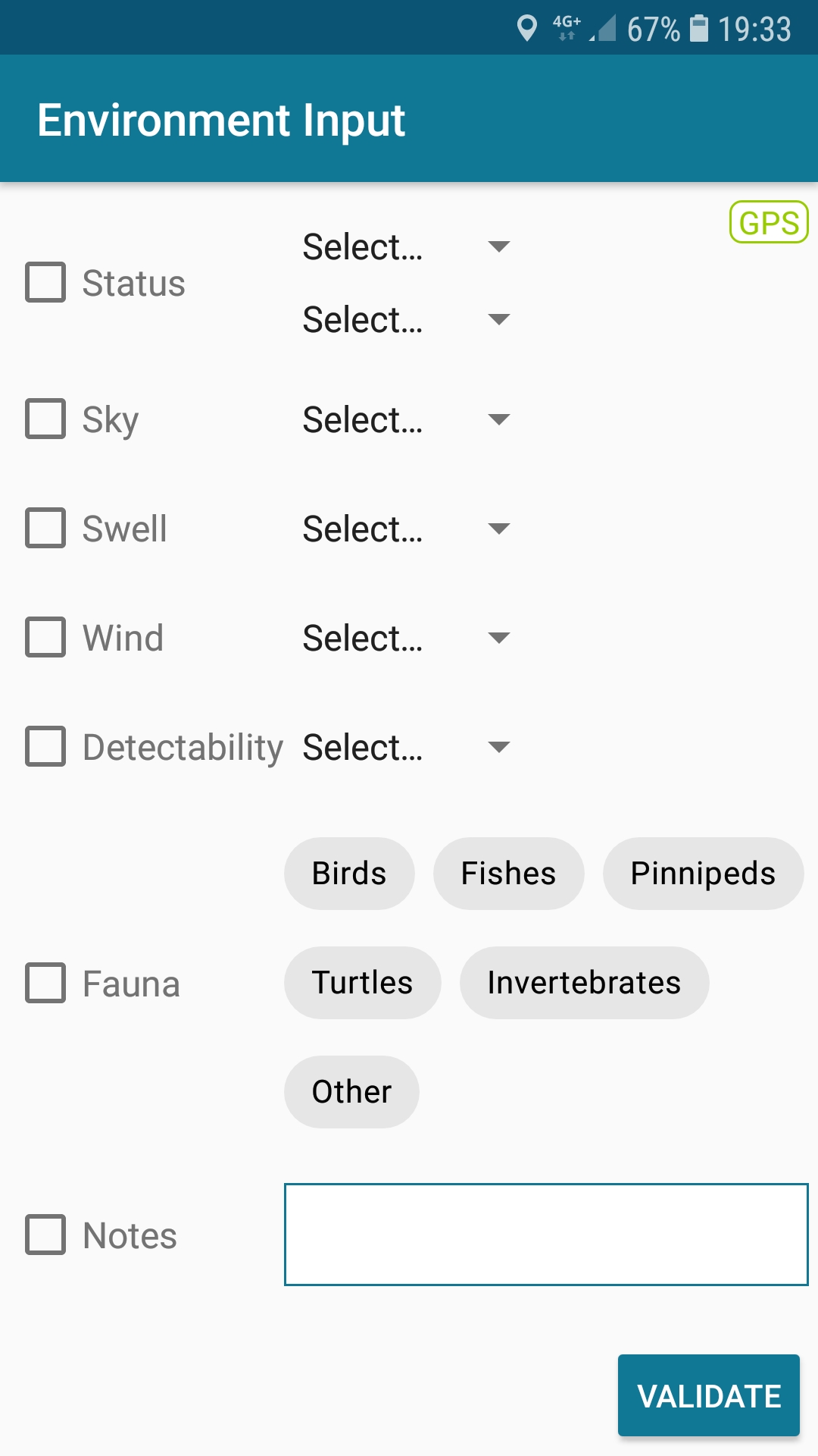
If you choose to start a survey, PADOC will now work as a simple logbook, in which you can, by tapping the Pencil button, regularly update environmental data (that you selected in the Home screen parameters) or write some custom notes. Every input is logged with the GPS position in your work file.
Colored indicators, on the left side of your Survey screen, help you to keep your environmental data valid. When your parameters have been recently (less than 25 minutes) updated or confirmed, they are accompanied by a green light. If the last confirmation for an environmental parameter is too old (more than 1 hour), the light is red. Between the green and red status, the light will be yellow, in order to remind you that an update or a confirmation of this parameter would be a good idea to keep your environmental logbook updated with valid data.
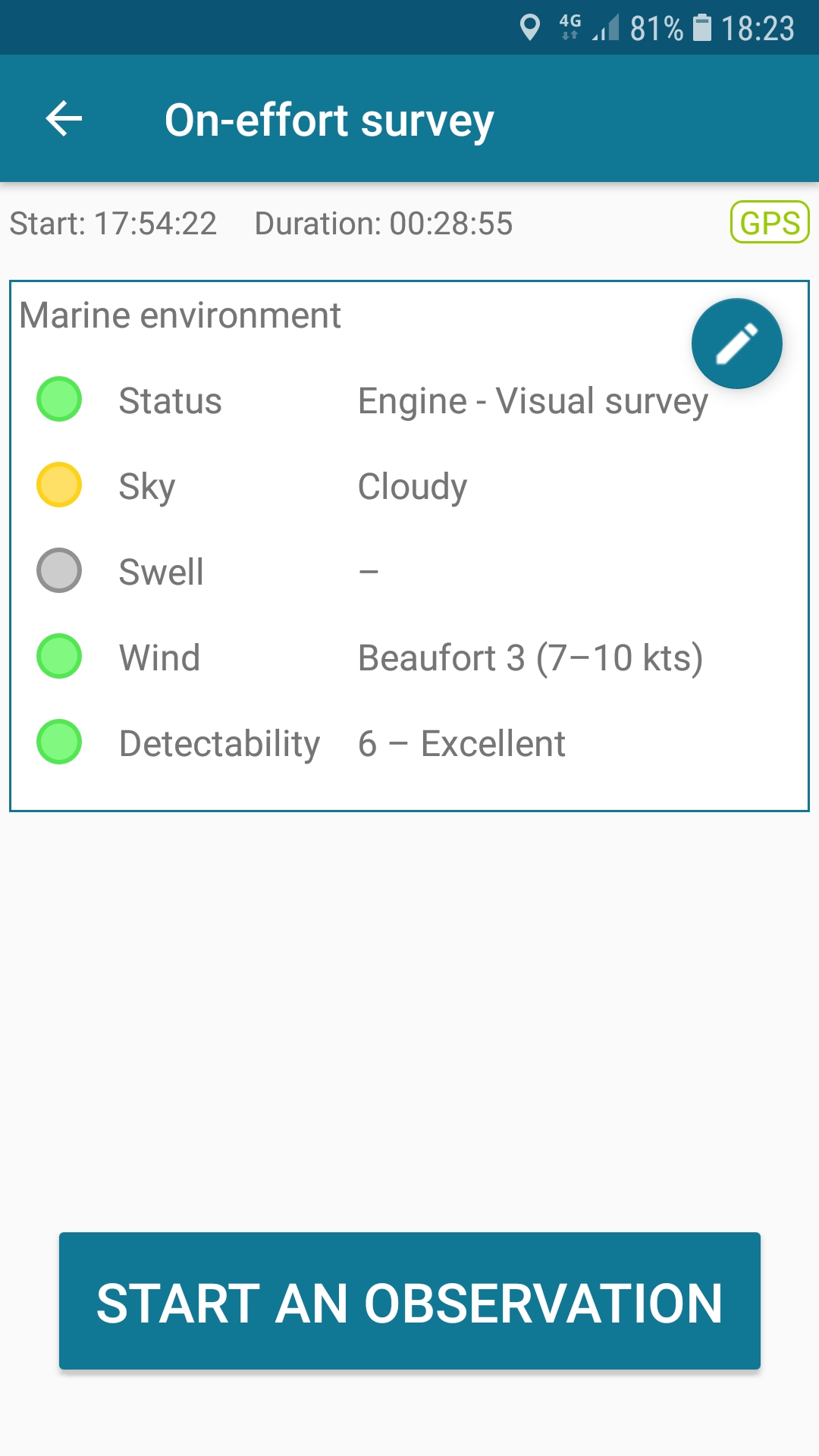
Note that in the environmental data entry screen, you will actually see two distinct types of parameters, separated by an horizontal line: « continuous » (e.g. swell, detectability, etc) and « discrete » (local depth, fauna or waste presence, etc).
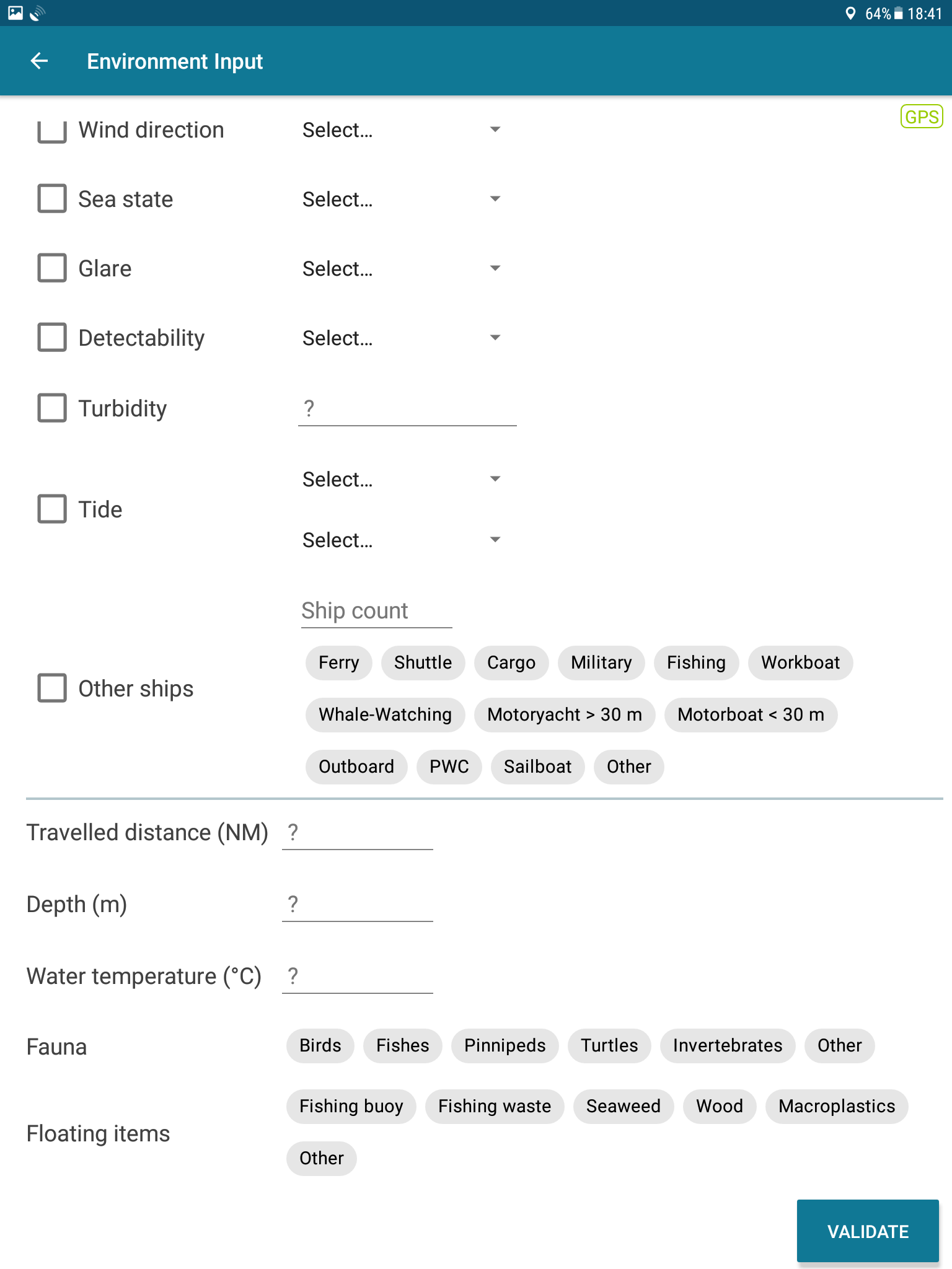
You will only see on the Survey home screen the continuous parameters, along with their colored indicators; they will automatically be written in each line of your survey logfile, as long as they are valid (i.e. green or yellow). The behaviour of the discrete data is different: they will only be written in the line corresponding to their validation, and will not be written in the subsequent lines except of course if you specify them again.
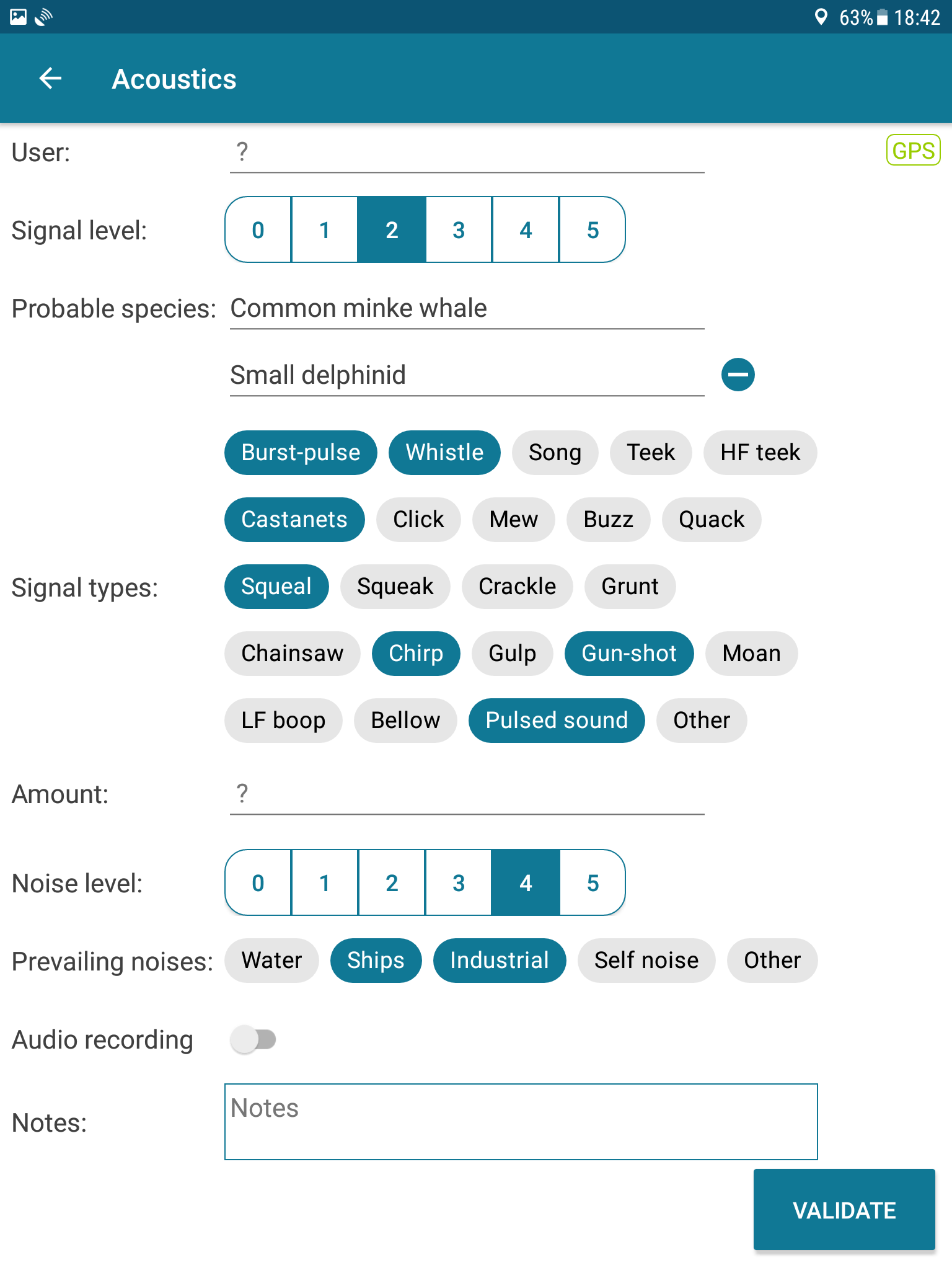
If you enabled the Acoustics data entry option, you can use it by tapping on the pulse-looking button.
Several parameters are then available to summarize what you just heard with your hydrophone.
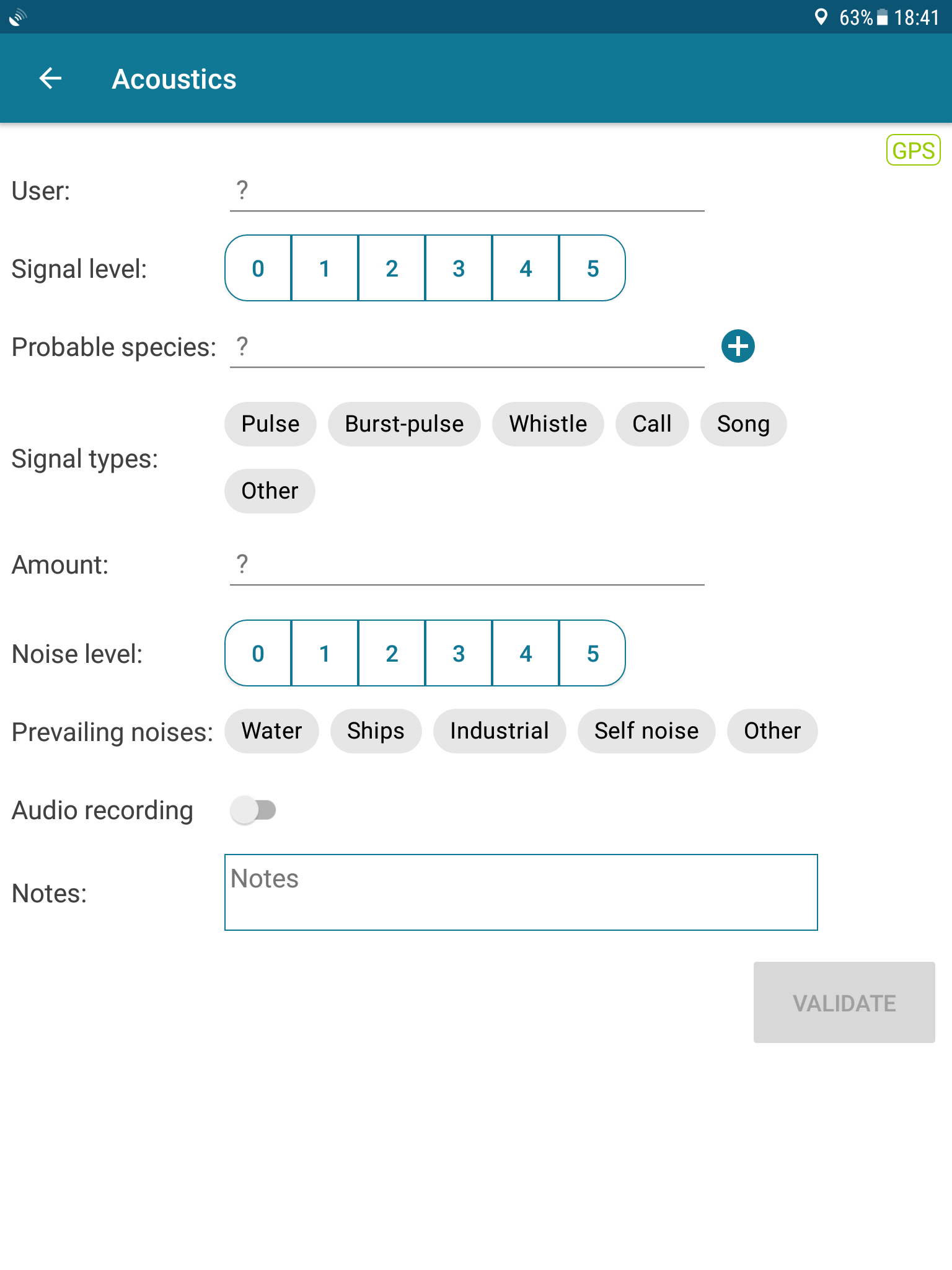
Basic signal types are available if you don’t select any species, but if you select one species (use the vernacular names and a drop-down list will appear; note that if you’re unsure you can select some wider taxonomic group, e.g. « Large delphinid » is a valid choice), a list of acoustic signals specific to the species you chose will be available. You can tick as many of them as you want.
A note to our users that have chosen to run the app with the Spanish, Portuguese or Italian language:
In order to avoid any mistake, and considering that the English terms are often used in science papers or in cetologic fieldwork, after consideration we finally chose to display the English terms for the acoustic signals, and we are sorry for any inconvenience that could arise.
Back to the Survey home screen, you can now tap the “Start an observation” button; in the first « New observation » dialog box (note that this box doesn’t appear if you start a behavioural observation directly from PADOC home screen), you can log the basic detection parameters of your sighting.
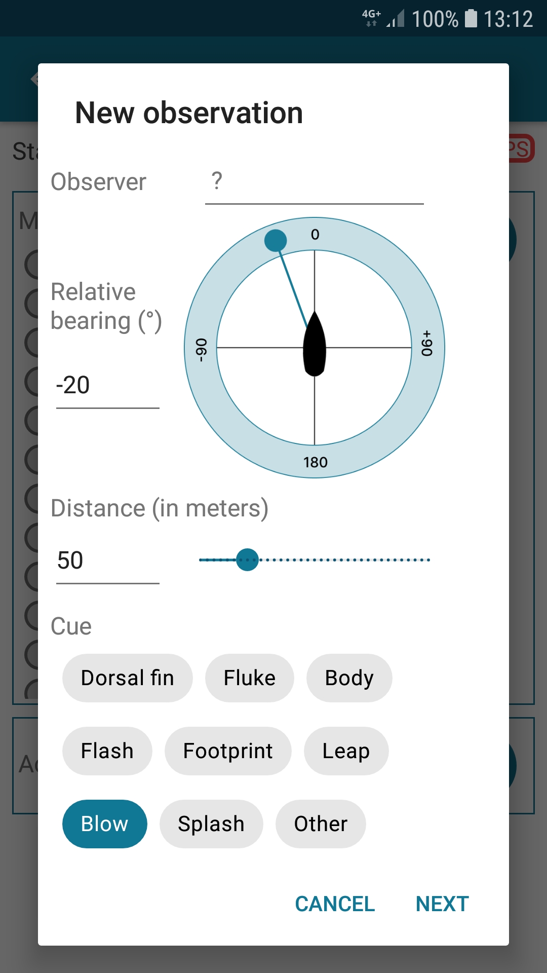
Then tap « Next » to access the second “New observation” dialog box.
In this new dialog box, select the species (select first the “Area” to find the species more easily).
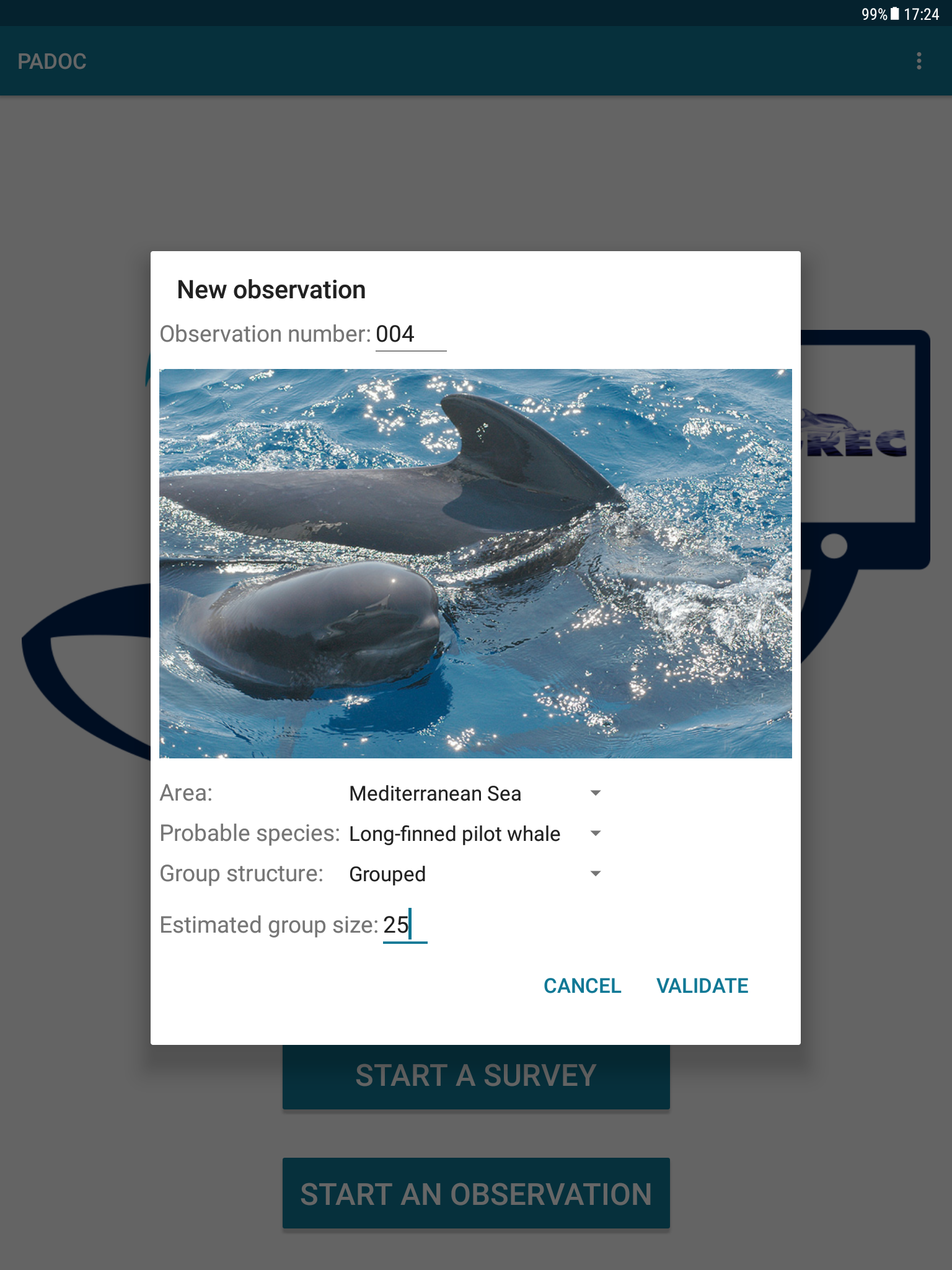
You can also indicate some other preliminary informations, then tap the “Validate” button to start the observation.
You are now in the “Events” screen, ready to record events.
In the top right corner, the GPS icon tells you if the GPS is ready (green) or still looking for its position (orange). If green, you can click on it to see your GPS position. If the GPS is not activated on your device, the GPS icon will be red until you activate the localisation feature.
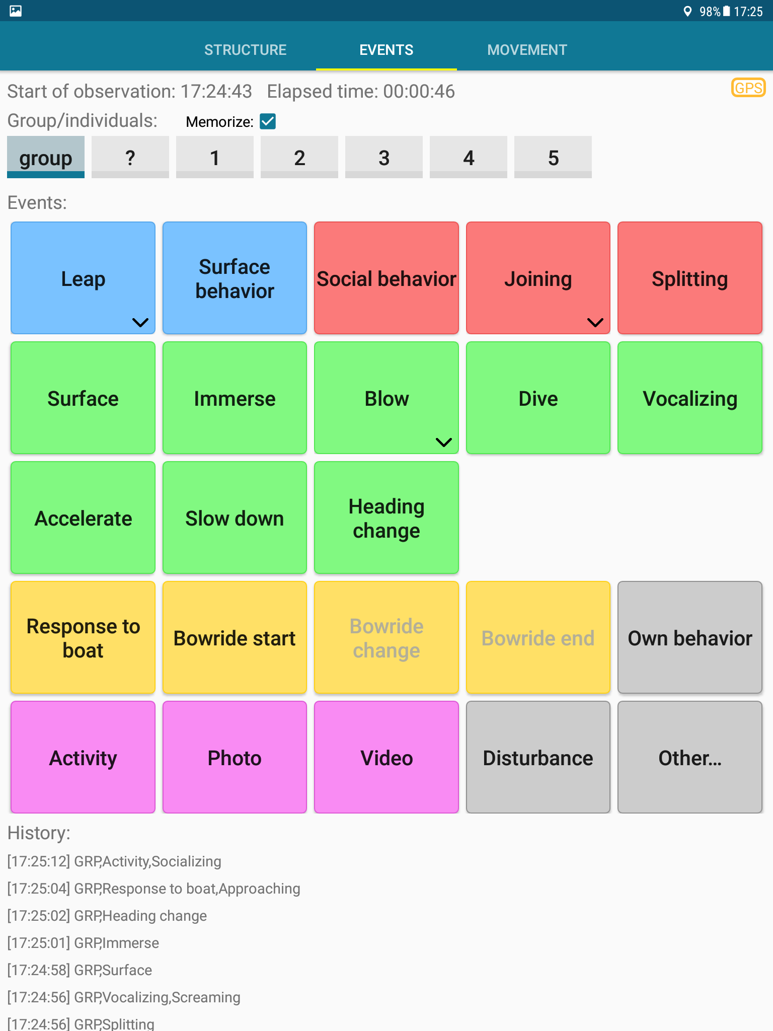
The first line of switches lets you define on which individuals the events will be applied. You can selected several individuals or the whole group.
Note that apart from the Activity button that refers to a durable state, all the buttons refer to ponctual events and elementary behaviours.
All the buttons in the middle are the events you can record. Buttons with a small arrow in the bottom right corner allow you to enter more details (or to access an option, such as resetting the blow count) if you long press on them.
At the bottom of the screen, you can see the list of already recorded events. A long press on one item proposes you to delete it.
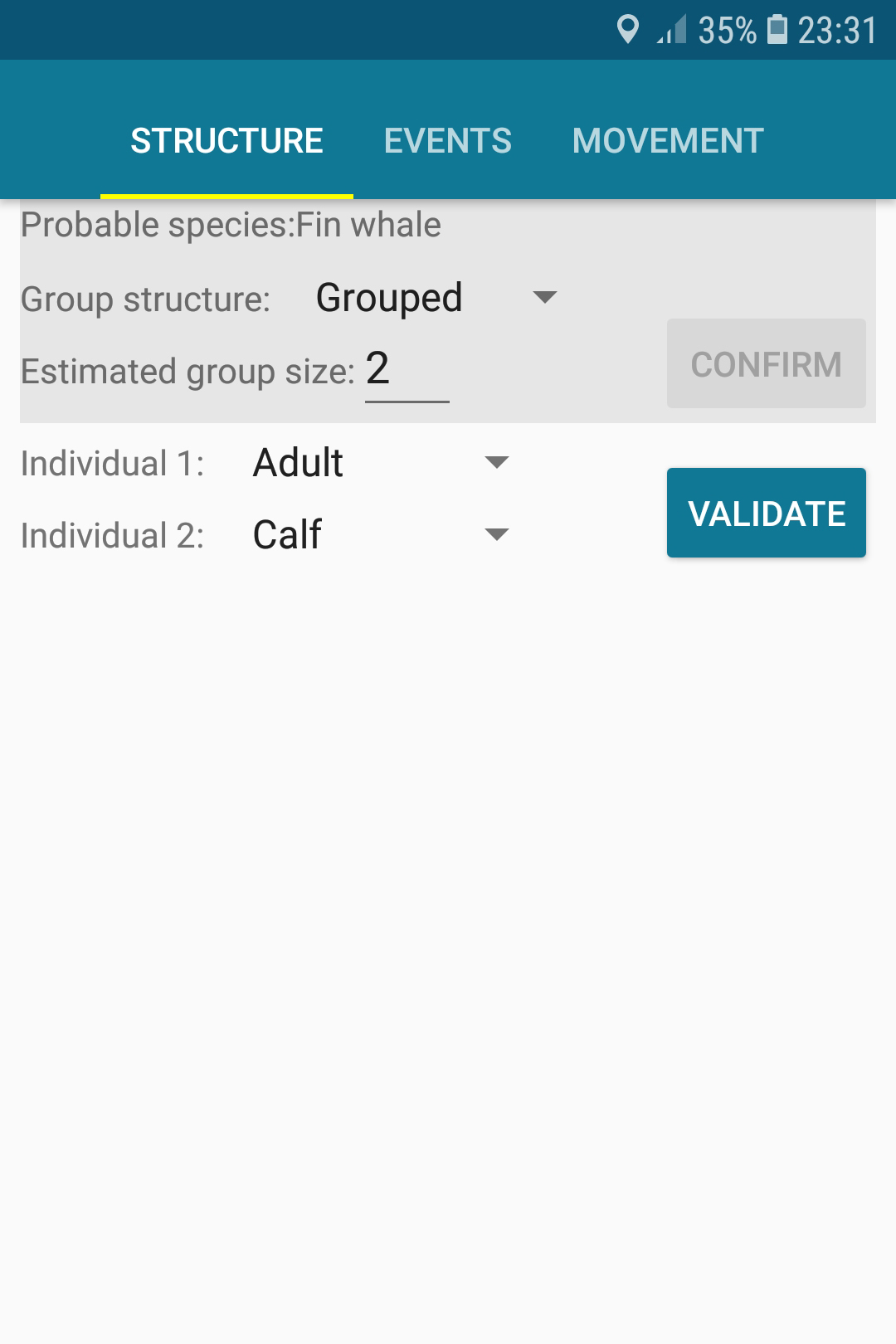
To change the estimated group size or the group structure, swipe to the right (or tap “Structure” in the tab bar).
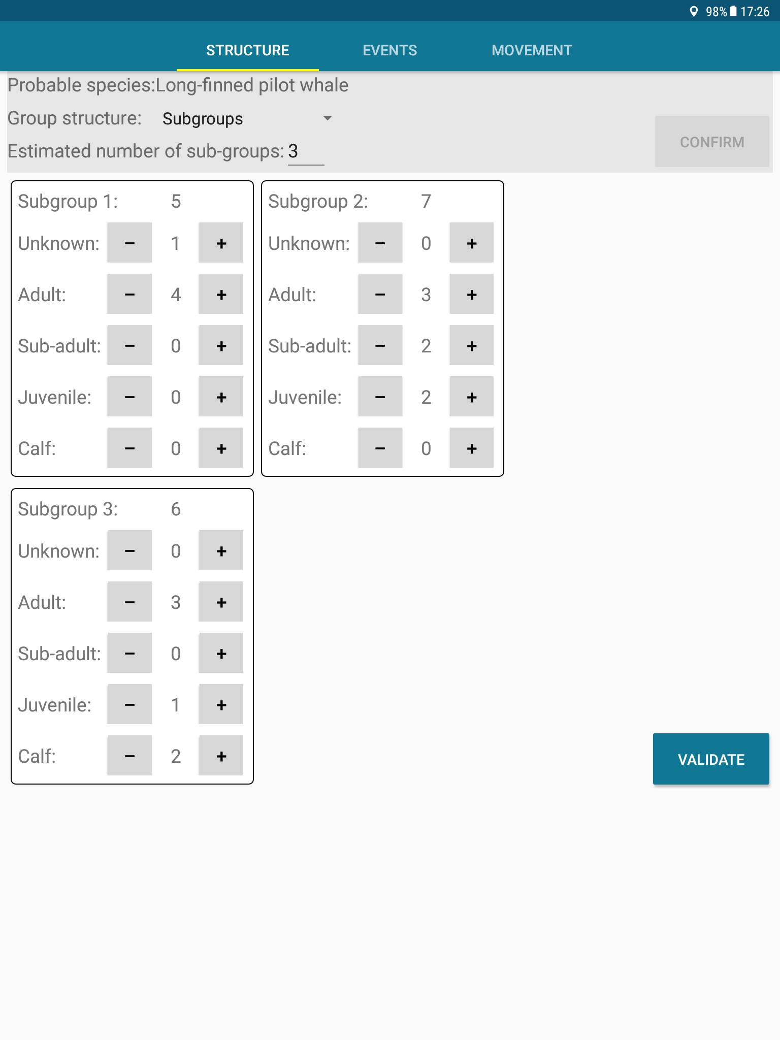
Just tap “Confirm” to save your changes.
You can also give more details on the composition of the group. Don’t forget to “Validate” your changes to save them.
Note that if there is less than 5 individuals in the group you are studying, the « Structure » panel is designed so that you can individually identify each animal:
To enter data about speed and position of the cetaceans, swipe to the left (or tap “movement” in the tab bar).
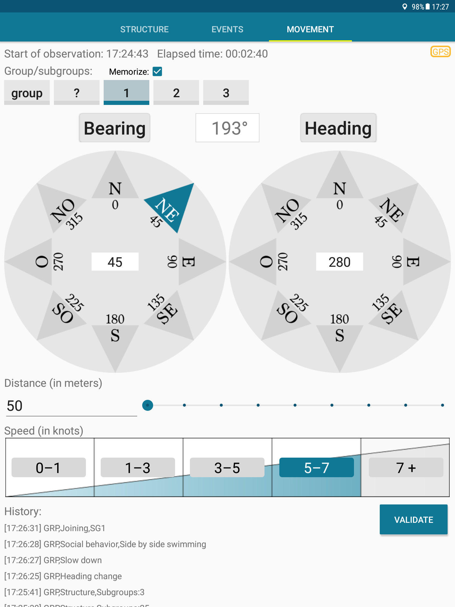
To enter the heading or the bearing, you have 3 possibilities:
- 1 Click on one of the arrows in the corresponding compass
- 2 Tap the center of the compass and enter a value with the keyboard
- 3 Point the device to the wanted direction and tap the button (« Bearing » or « Heading ») on the top of the compass
You can also enter the distance of the cetaceans and their speed range (tap the button with the correct speed range).
And don’t forget to validate the entered data.
When the observation ends, tap the “back” button of your Android device and validate.
PADOC is ready to resume the survey, or for another observation.
Analysis of CSV files
All CSV files are stored by default in the “Android/data/org.cetaces.padoc/files” folder. On recent Android versions (7 and newer), you can choose yourself where you want your datafiles to be saved.
The files can easily be open with spreadsheet tools (like LibreOffice or Excel). Note that your data files will be erased from your device if you uninstall PADOC, and that we never have access to your files : so don’t forget to backup your data regularly !
The first line of the files contains a header describing each column.
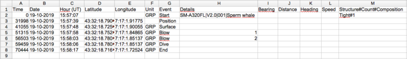
In the « LOG_xxx…xxx » files (that are the files produced in Survey mode), if you disabled one or several environmental parameters, they are flagged with a ‘N/A’ indicated in the first row of the corresponding column; he following rows are simply left blank. You can then keep these columns or delete them from your file, as you prefer.
Last but not least !
Play a little bit with the app and the CSV files before going to sea. You will better understand how it works, the recording of data will be smoother and the analysis easier.
Thanks for flying PADOC
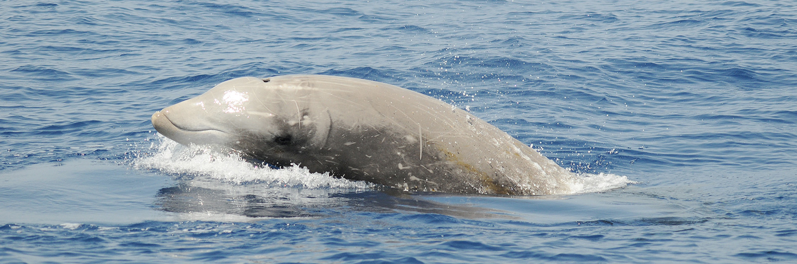
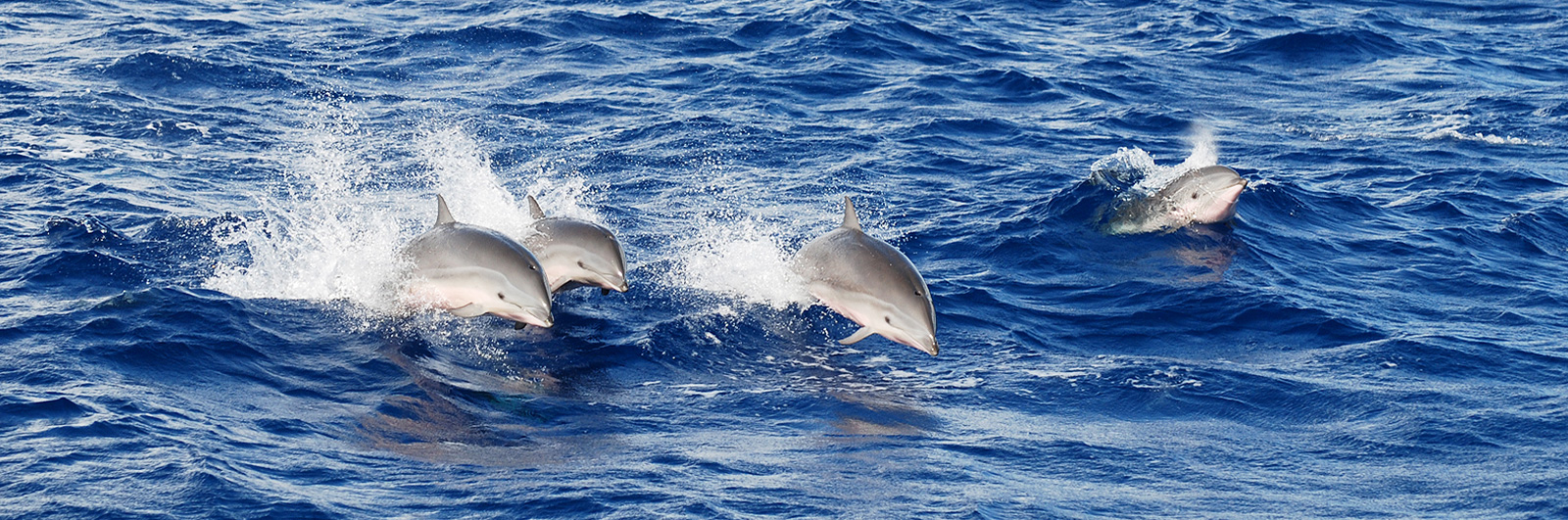
And if you want to help us…! As you have probably noticed, some species are present in the app but are not illustrated with any good picture : unfortunately we have not been everywhere nor seen every cetacean ! For those species, we would be more than happy if you had a good picture and would agree to show it in the app. You can contact us right here. Thanks!
Of course, please don’t hesitate for any kind of suggestion that could improve the app: language corrections, addition of a geographical area or a behaviour, … thanks again!
Laurent Delrocq and Groupe de Recherche sur les Cétacés development team.